AGM Panoscan
Software for creation of digital cartographic products based on mobile laser scanning and panoramic photos in the Autodesk AutoCAD environment.
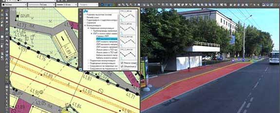
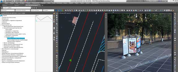
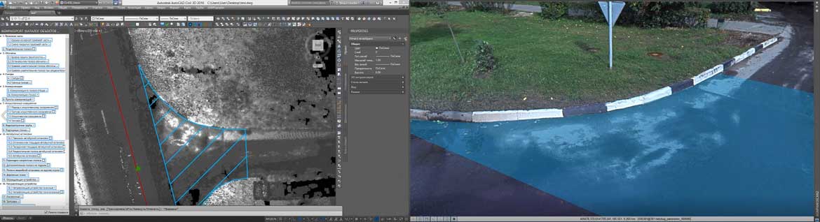
AGM Panoscan is designed for digitizing objects in Autodesk AutoCAD on spherical panoramas with using a digital terrain model obtained from mobile laser scanning data.
The program is compatible with versions of AutoCAD 2015-2016 64-bit and any products based on it.
Digitization on spherical panoramas allows to considerably accelerate and simplify the process of creating digital cartographic products. At the same time, all other Autodesk AutoCAD tools and viewports are available for use with other materials and data (raster of reflected pulse intensity, shaded DEM model, etc.).
When digitizing, only the standard editable objects of Autodesk AutoCAD are used, which allows you to replace some symbols with others in accordance with drawing units and scales (simplified generalization).
The architecture of the program and integration with AGM Topoplan provides the ability to configure the classifier and any of its elements, the integration of third-party classifiers under unique requirements (additional symbols, attribute information, layers, blocks, linetypes, fonts, text styles, color design, etc.)
Intuitive and user-friendly interface with the ability to quickly search, contextual help and preview.