Equipment
We offer high-precision equipment of our own production for various applications.
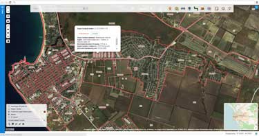
The technologies of laser scanning in cadastral operations increase the productivity and speed
The basis for cadastral work is topographic plans of the territory. Using the airborne survey data, mobile laser scanning and panoramic photography can reduce time and labor costs for building digital models of the surveyed territory.
Thanks to the using of modern technologies of GNSS and inertial navigation, it is possible to prepare engineering, topographic and situational plans of any accuracy in the required coordinate system.
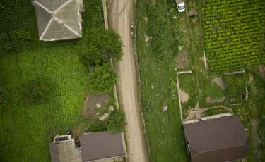
High performance is especially important when working with long linear objects, such as roads and railways, electric and gas supply networks, etc.
We offer high-precision equipment of our own production for various applications.
Our software allows to effectively process large volumes of remote sensing data.
We offer to our customers the complete production workflow.