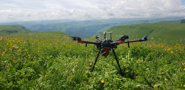
Equipment
We offer high-precision equipment of our own production for various applications.
The surveying of large areas with the necessary detail
Modern set of equipment and technologies for laser scanning (airborne / mobile / terrestrial), in addition to traditional spheres of practical application, such as topographic surveying and DEM, is increasingly used in environmental monitoring.
LiDARs are already used to control the dynamics of water surfaces of hydraulic structures (reservoirs, fish-breeding and technological ponds, irrigation systems and sludge accumulators), monitoring the change in river beds (with the possibility of determining the amount of erosion or sediment), detecting forest felling (with the determination of quantity, rock composition and volume of wood in the presence of retrospective data), in calculating the height of emissions and dispersion of pollutants in the atmosphere, as well as for monitoring monitoring of the sanitary protection zone by large industrial enterprises.
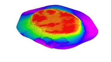
Laser scanning technologies are used in calculating the volumes of mining operations by the open method, the degree of filling of solid waste landfills and the volume of waste in illegal landfills.
We offer high-precision equipment of our own production for various applications.
Our software allows to effectively process large volumes of remote sensing data.
We offer to our customers the complete production workflow.