Equipment
We offer high-precision equipment of our own production for various applications.
Modern measurement technologies
Unlike terrestrial long-range laser scanners or traditional geodetic methods, the using of UAV in addition to higher performance has several additional advantages:
› there is no need to navigate the subject of research for finding optimal scan points or for traditional geodetic measurements;
› the points from which it is possible to survey using ground methods may be difficult to access or not at all. For the UAV, there are no such restrictions;
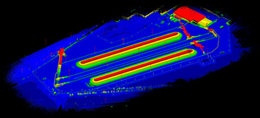
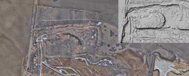
› for one day you can completely survey the object (for example, quarry), process the data and get the measurement results (for example, the amount of extracted rock);
› airborne laser scanner can be used in harmful production situations, when the location of a ground personnel at the facility is hazardous to health.
A wide variety of multi-copters, unmanned planes and helicopters allows you to select a drones for the requirements of a particular customer. Airborne laser scanner for UAV AGM-MS3 can operate completely autonomously for several hours, so it is possible to easily survey any object of interest.
We offer high-precision equipment of our own production for various applications.
Our software allows to effectively process large volumes of remote sensing data.
We offer to our customers the complete production workflow.