Equipment
We offer high-precision equipment of our own production for various applications.
The fastest, most accurate, presice and complete data on the road in any coordinate system
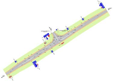
Inventory and diagnostics of highways and artificial structures is an important part of the complex of works that allow to effectively manage the road economy. For effective planning of works on maintenance and repair of roads, it is necessary to have up-to-date and complete information about them: the place of passage, the extent, availability of road structures and their condition.
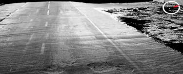
The most suitable technology for obtaining these data is the application of mobile laser scanning and panoramic photography. Their advantages: completeness of the data, high accuracy and presicion, reliability and speed of surveys. For one working day, mobile mapping scanning system can survey hundreds of kilometers of roads.
An important component of the technology is obtaining information about roads and facilities on it not only with reference to a linear kilometer. Each object has precisely measured three-dimensional coordinates in a single coordinate system. Data obtained by mobile laser scanning can be used later by design organizations.
We offer high-precision equipment of our own production for various applications.
Our software allows to effectively process large volumes of remote sensing data.
We offer to our customers the complete production workflow.